
Tours / Himalayan treks
Laya-Lingshi Trek and Himalayan Cultural Odyssey
Nineteen days on one of Bhutan’s great treks, past Jomolhari and Lingshi to the village of Laya and the hot springs of Gasa.
Trip at a glance
- Duration19 days, 18 nights
- Main stopsParo, Thimphu, Punakha
- Starts and endsParo
- Travel styleTrekking
- TrekAbout 12 days
- Best seasonSpring and autumn
Overview
The Laya-Lingshi trek follows the Jomolhari route to Jangothang, then continues north through some of Bhutan’s most remote country, past Lingshi Dzong and over high passes to Laya, home of the Layap people. It ends at Gasa, where hot springs wait.
Days in Paro, Thimphu and Punakha frame the trek. It is a demanding expedition for experienced trekkers.
Good to know
Every journey is private and can be adjusted to your pace and interests.
Highlights
Two days beneath Jomolhari at Jangothang
Lingshi Dzong above its wide valley
Laya village and the Layap people
The hot springs at Gasa
The hike to Tiger’s Nest
- Paro
- Thimphu
- Punakha
- Paro
Day by day
The full itinerary, day by day. Every journey is private, so we can adjust the pace, hotels and stops to suit you.
Day01
OvernightParo
Arrive in Paro and explore the valley
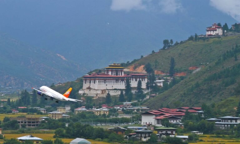
Arrive at Paro International Airport, enjoying majestic mountain views on the approach if the weather is clear, as the aircraft descends between forested ridges to the valley floor. Your guide meets you at the terminal, and after settling into your hotel you begin exploring the Paro Valley at an easy pace, which helps your body start adjusting to the altitude.
Visit Kyichu Lhakhang, one of Bhutan’s oldest temples, traditionally dated to the 7th century, where residents circle the temple and turn its prayer wheels. Then visit Rinpung Dzong, the 17th-century fortress above the Paro Chhu, crossing the covered wooden bridge to its courtyards and temples. In the evening, stroll through Paro town and meet your guide for a trek orientation, covering the route, the support crew, daily routines on the trail and the kit you will need.
Day02
OvernightThimphu
Paro to Thimphu: the modern capital
Drive to Thimphu, Bhutan’s dynamic capital, about an hour and a half from Paro. On the way, stop at Tamchog Lhakhang, the Iron Bridge Temple, a private temple associated with the 15th-century saint Thangtong Gyalpo, reached by crossing the Paro Chhu on a traditional iron chain bridge strung with prayer flags.
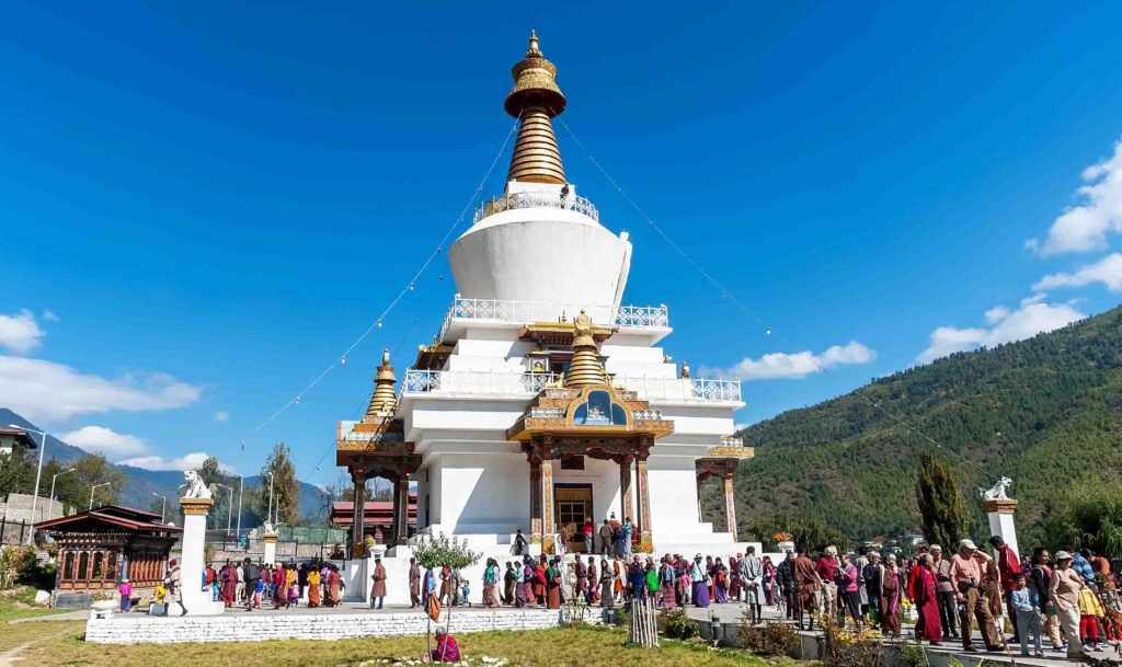
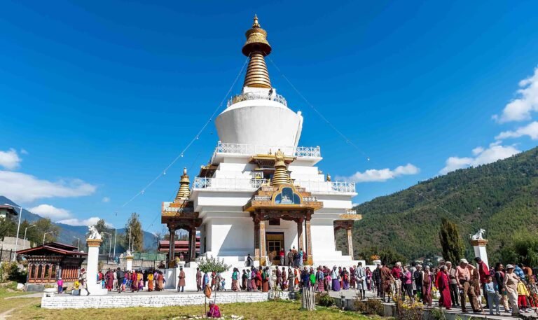
In Thimphu, visit the Buddha Dordenma, the giant gilded statue on the hill of Kuensel Phodrang, with sweeping views over the valley, and the National Memorial Chorten, where residents walk and pray throughout the day. Later, explore Thimphu’s craft markets, where you can browse textiles, masks and other handicrafts and pick up any last items for the trek. Spending time at Thimphu’s altitude of around 2,320 metres is useful acclimatisation before you head into the mountains.
Day03
OvernightThimphu
Day trip to Punakha over Dochula
A full day trip from Thimphu. Drive across Dochula Pass, at 3,100 metres, for panoramic Himalayan views on clear days, and pause at the 108 Druk Wangyal chortens before descending through forest into the warm Punakha Valley, where rice terraces line the rivers.
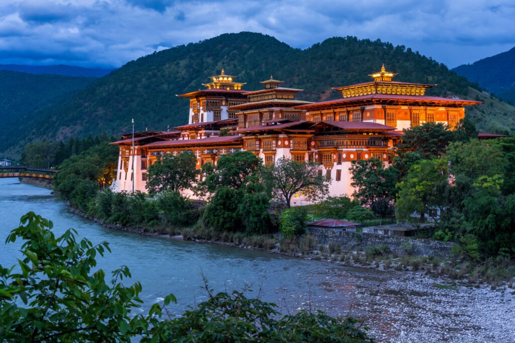
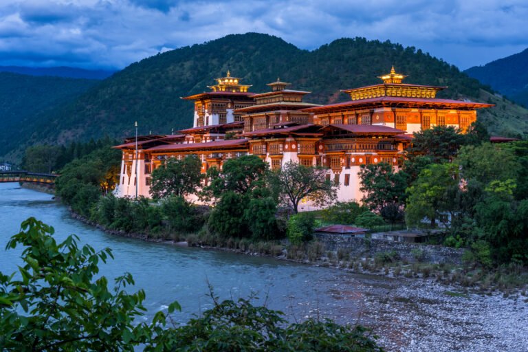
Visit Punakha Dzong, Bhutan’s most beautiful fortress, built in 1637 at the confluence of the Pho Chhu and Mo Chhu and the winter home of the central monastic body. Walk through the rice fields to Chimi Lhakhang, the Fertility Temple of Drukpa Kunley, a pleasant stroll past village houses. In the evening, return to Thimphu. Climbing to the pass and returning to sleep lower is useful acclimatisation before the long trek ahead, which spends many nights above 4,000 metres.
Day04
OvernightThimphu
Thimphu: trek preparation
Spend a leisurely morning exploring the city. Visit the Motithang Takin Preserve, where you can see the takin, Bhutan’s national animal, which you may later encounter in the wild on the trek, and Tashichho Dzong, the fortress that houses the seat of government and the summer quarters of the central monastic body.
In the afternoon, join a pre-trek briefing and equipment check with your expert mountain guide. You will go through the route day by day, the high passes, the camps, the support crew and pack animals, and what to carry in your daypack, and check boots, warm clothing, rain gear and sleeping bag. Your guide will also explain how altitude is managed on the trek and what to do if you feel unwell. Use the evening to rest and pack.
Day05
OvernightCamp at Thangthanka
Trek begins: Sharna Zampa to Thangthanka
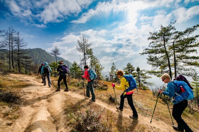
Drive from Thimphu through the Paro Valley to Gunitsawa, near Sharna Zampa, where the trek begins and where the pack animals and crew are waiting. The trail follows the Paro Chhu upstream through rhododendron and oak forest, crossing the river on wooden bridges as the valley narrows.
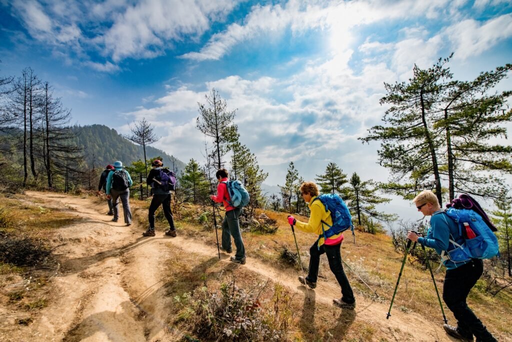
This is a long first day of gradual climbing through dense forest, where you may spot birds and, with luck, Himalayan wildlife such as langurs or deer along the way. Walk at a steady pace and drink plenty of water. The camp at Thangthanka is set in a meadow surrounded by forest, and on clear evenings the snow summit of Jomolhari appears at the head of the valley. Dinner is served in the dining tent as the temperature drops in the evening.
Distance about 18 km. Walking time 6 to 7 hours.
Day06
OvernightCamp at Jangothang
Thangthanka to Jangothang
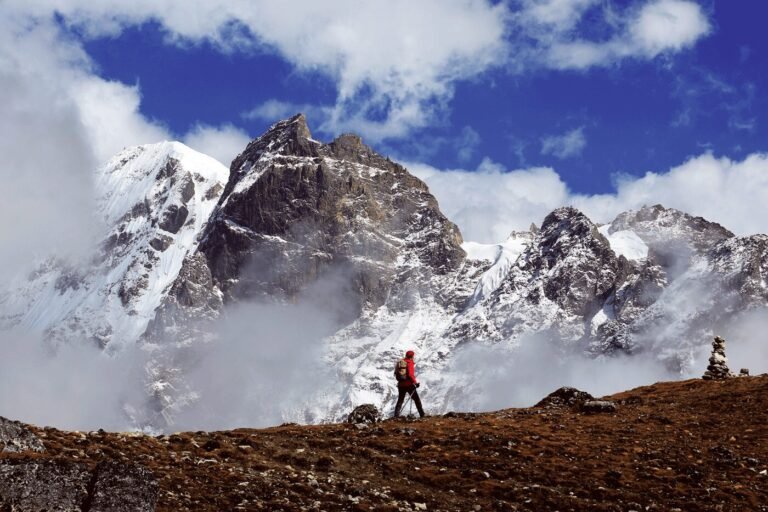
Ascend steadily up the valley as the forest thins and gives way to high pastures dotted with yak herders’ houses. The views of Jomolhari and Jichu Drake become more breathtaking with every step, and herds of yaks graze on the slopes around the stone settlements.
The camp at Jangothang lies in a wide meadow directly beneath the towering north face of Jomolhari, at 7,326 metres, one of the most majestic settings in the Himalaya, beside the ruins of a small dzong. As the sun sets, the snow peaks glow above the camp. At this altitude, take it easy, keep warm and drink plenty of fluids. Your guide will check on how you are feeling, as the next days take you higher still.
Distance about 19 km. Walking time 5 to 6 hours. Camp at about 4,080 m.
Day07
OvernightCamp at Jangothang
Acclimatisation day at Jangothang
A day to rest and acclimatise beneath Jomolhari before the long journey north. Climbing a little higher during the day and returning to sleep at the same altitude is the best way to prepare your body for the high passes ahead.
Optional hikes include walking towards Jomolhari base camp and the foot of the glacier for close views of the mountain, or climbing to Tshophu, a pair of high lakes above the camp where blue sheep are often seen on the surrounding slopes. The day is ideal for photography, as the light changes on the peaks, and for meeting the herding families who spend the summer here with their yaks. Rest well in the afternoon, keep drinking water and enjoy the stillness of one of the Himalaya’s great campsites.
Day08
OvernightCamp at Lingshi
Jangothang to Lingshi over Nyile La
Cross Nyile La, at around 4,700 metres, the first high pass of the trek, after a steady climb from Jangothang. From the pass there are panoramic views of snow peaks, including Jomolhari, Jichu Drake and Tserim Kang, before the trail descends into the remote Lingshi Valley.
The valley is a wide, open basin surrounded by mountains, and Lingshi Dzong, also known as Yugyal Dzong, stands on a hilltop above it. Built in the 17th century, it once guarded the trade route between Bhutan and Tibet. The village of Lingshi, with its stone houses and fields of barley, lies on the slopes nearby. The camp is set in the valley with views of the ancient dzong, and after a long day at altitude, rest is welcome.
Distance about 18 km. Walking time 6 to 7 hours. Camp at about 4,010 m.
Day09
OvernightCamp at Chebisa
Lingshi to Chebisa
Today is a shorter walking day, a welcome chance to recover after the crossing of Nyile La. The trail leaves Lingshi and follows the hillside past the village of Goyul, where stone houses cluster together on the slope, a rare sight in Bhutan, where village houses are usually spread out among their fields.
The route continues to Chebisa, a small village in a beautiful side valley, with a tall waterfall tumbling down the cliffs behind it. The camp is set near the village, and in the afternoon there is time to walk among the houses, where your guide may be able to arrange a visit to a local home. The highland villages of this region are among the most remote in Bhutan, and their people keep a traditional way of life based on yaks and barley.
The original itinerary gave figures for this day that belong to another stage; we are confirming the distance and camp altitude.
Day10
OvernightCamp at Shomuthang
Chebisa to Shomuthang over Gombu La
Climb steeply out of Chebisa to Gombu La, the Gobu La of the original itinerary, at around 4,410 metres, crossing into pristine wilderness. The trail passes through alpine meadows and rhododendron scrub, where edelweiss and other mountain flowers grow in summer, and blue sheep are often seen on the slopes above.
From the pass, the route descends and then rises and falls through a series of valleys and ridges, passing herders’ camps used in the summer months. The camp at Shomuthang lies beside a stream in a high valley, surrounded by open grassland and rugged hills, far from any village. Nights here are cold, so wrap up well. The sense of remoteness grows each day as the trek heads deeper into the northern mountains towards Laya.
Distance about 17 km. Walking time 6 to 7 hours. Camp at about 4,220 m.
Day11
OvernightCamp at Robluthang
Shomuthang to Robluthang over Jhari La
Cross Jhari La, also written Jare La, at around 4,700 metres, after a steady climb from Shomuthang. On clear days the pass offers views of the surrounding peaks, possibly including Gangchen Ta, the “great tiger mountain”, and the snowy summits of the northern range.
From the pass, descend steeply into the Tsharijathang Valley, an area known for its herds of takin, which migrate here in summer, and for Himalayan blue sheep and yak herders. The trail crosses the river and climbs again to the camp at Robluthang, set in a rocky meadow high above the valley. It is a demanding day, with a high pass and a significant descent and re-ascent, so take your time and keep drinking water throughout.
Distance about 18 km. Walking time 6 to 7 hours. Camp at about 4,160 m.
Day12
OvernightCamp at Limithang
Robluthang to Limithang over Shinje La
Today you ascend Shinje La, also written Sinche La, at around 4,900 to 5,000 metres, the trek’s highest and most rewarding point. The climb is long and steady, but the pass offers awe-inspiring Himalayan panoramas, with snow peaks and glaciers in every direction, and prayer flags snapping in the wind.
From the pass, the trail descends steeply through moraine and alpine meadows to the river below, passing beneath impressive peaks, including Gangchen Ta, which dominates the upper valley. The camp at Limithang is set in a beautiful meadow beside the river, with views of the mountain. Reaching camp after crossing the highest pass is a real achievement, and the evening is a good time to celebrate with your crew. The descent towards Laya begins tomorrow.
Distance about 19 km. Walking time 6 to 7 hours. Camp at about 4,140 m.
Day13
OvernightCamp at Laya
Limithang to Laya
A shorter day descends through forest along the river valley to Laya, one of the highest villages in Bhutan, at around 3,800 metres. The trail passes through conifer and rhododendron forest, with views back towards the mountains you have crossed, before emerging above the village and its fields.
Laya is home to the Layap people, who have their own dialect, customs and dress. The women are known for their distinctive conical hats of woven bamboo, topped with a small spike, worn with dark woollen clothes and silver and bead jewellery. The village is spread across the hillside, with houses of stone and wood surrounded by fields of barley and turnips. The camp is set near the village, and arriving in a living community after many days in the wilderness is a special moment.
Distance about 10 km. Walking time 4 to 5 hours. Camp at about 3,800 m.
Day14
OvernightCamp at Laya
Laya: rest day
A full day in Laya to rest and immerse yourself in the life of Bhutan’s northernmost community. After the long days on the trail, a slower pace is welcome, and the day offers plenty to see and do in and around the village.
With your guide, walk through the village, visit homes where families may offer butter tea, and learn about the Layaps’ way of life, which revolves around yak herding, barley farming and, more recently, the collection of cordyceps, a valuable medicinal fungus gathered on the high pastures in early summer. The village temple, the views of the surrounding peaks and the warm highland hospitality make this a memorable day. It is also a good opportunity to wash clothes, rest your legs and prepare for the descent towards Gasa.
Day15
OvernightCamp at Koina
Laya to Koina
Leave Laya and begin the long descent towards Gasa. The trail drops steeply through lush forests along the Mo Chhu river, passing waterfalls and crossing side streams on wooden bridges. As you descend, the vegetation changes from high conifer forest to mixed broadleaf woodland, rich in birds and plants.
The route follows the river gorge for much of the day, with stretches of muddy trail, especially after rain, so take care with your footing. The camp at Koina is set in a forest clearing near the river, much lower and warmer than the high camps of the previous week. The change in altitude is noticeable: the air is thicker, the forest is dense and green, and many trekkers enjoy their best night’s sleep of the trek.
Distance about 19 km. Walking time 6 to 7 hours. Camp at about 3,050 m.
Day16
OvernightPunakha
Koina to Gasa, end of trek, and drive to Punakha
The final day of the trek climbs from Koina to Bari La, at around 3,900 metres, before descending through forest towards Gasa. From the pass there are views over the forested valleys of the north, and the trail drops steadily to the road near Gasa Dzong, the 17th-century fortress that once guarded the northern routes to Tibet, where the trek concludes.
In the afternoon, enjoy a therapeutic soak at Gasa Tshachu, the hot springs on the banks of the Mo Chhu below the dzong, which Bhutanese families visit for their reputed healing properties. After many days on the trail, the warm water is a wonderful reward. Then say farewell to the crew and drive south down the valley of the Mo Chhu to Punakha, arriving in the evening for a comfortable night in a hotel.
Distance about 14 km. Walking time 6 to 7 hours.
Day17
OvernightParo
Punakha to Paro
Spend a relaxed morning exploring the Punakha Valley at your own pace after the trek. Depending on your interests, visit Punakha Dzong again in the morning light, walk across the suspension bridge over the Pho Chhu, or stroll through the rice fields to a nearby village.
In the afternoon, drive back over Dochula Pass, where on clear days the Himalayan peaks you have just trekked beneath may be visible on the northern horizon, and continue through Thimphu to the Paro Valley. In the evening, unwind with a traditional hot stone bath, in which river stones heated in a fire are lowered into a wooden tub of water, often scented with herbs, the perfect way to soothe muscles after almost two weeks on the trail.
Day18
OvernightParo
Hike to Tiger's Nest Monastery
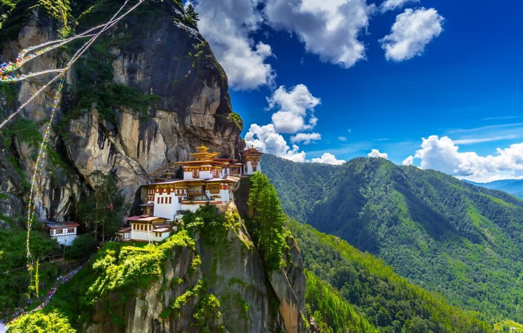
A full day to ascend to Taktsang, the Tiger’s Nest, Bhutan’s most revered pilgrimage site, perched on a granite cliff about 900 metres above the Paro Valley. According to legend, Guru Rinpoche flew here on the back of a tigress in the 8th century and meditated in a cave around which the monastery was later built.
After your trek, the climb through blue pine forest hung with prayer flags will feel easy, and you can take your time at the café and viewpoint halfway up. Inside the monastery, small temples lit by butter lamps hold statues of Guru Rinpoche and other deities. It is a fitting place to reflect on your Himalayan journey, from the high passes and herders’ camps to the villages of Laya and the hot springs of Gasa.
Day19
Depart from Paro
After breakfast, your guide transfers you to Paro International Airport for your departure. If time allows, stop at a viewpoint above the valley for a last look at Rinpung Dzong and the surrounding ridges.
As your flight climbs out of the Paro Valley, look out for the high peaks on clear days, perhaps even Jomolhari and the mountains of the northern range that you crossed on foot. You leave with unforgettable memories of one of the great treks of the Himalaya: the base camp beneath Jomolhari, the ancient dzong at Lingshi, the high passes and the warm welcome of the Layap people. At the airport your guide bids you farewell with a heartfelt “Tashi Delek”, wishing you good fortune.
Good to know
- Private journeyPlanned around your dates, pace and interests
- GuideA licensed Bhutanese guide accompanies you throughout, as Bhutan requires
- ArrivalParo International Airport
- PriceDepends on dates, hotel category and group size; our prices include the government’s Sustainable Development Fee
Treks reach high altitude. Good fitness and comprehensive travel insurance, including evacuation cover, are strongly recommended.
Places on this route
Explore more: Himalayan treks in Bhutan · best time to visit · visa and SDF
You may also like
Druk Path Trek and Cultural Immersion
9 days. The Druk Path from Thimphu to Paro past high lakes.
Jomolhari Trek
13 days. To Jangothang beneath Jomolhari, then over to Lingshi.
Snowman Trek
Bhutan's most demanding trek. Itinerary on request.
Tell us how you would like to travel
Share your dates, interests and preferred pace. We reply personally with ideas for your route and a clear quote.
Prefer to chat? WhatsApp +975 77888822